Teaching medieval Bruges with Bruges 1562
Bruges 1562 lets a class walk through Bruges as it stood in 1562, rebuilt in 3D street by street from sources, in a browser. This page gives ideas for a history lesson in secondary school.
Why the town of 1562
In 1562 Bruges was still largely a medieval town, and a well documented one. It also stood at a turning point that pupils can see in the streets. The Hanse had moved its house to Antwerp and the silting of the Zwin had cut the sea trade. A papal bull of 1559 had made Bruges a diocese, with Sint-Donaas on the Burg as its cathedral. The town council had the city drawn, house by house, in a plan of 1562. The guides to Bruges in 1562 and medieval Bruges and the timeline give the background.
Five themes for a lesson
Trade and the Zwin
A storm flood of 1134 opened the Zwin, and down it the ships of Bruges reached the open sea. Pupils can follow the goods: the crane on its quay lifted wine and beer casks from the ships, the Waterhalle let boats sail into the Markt, and merchants met to trade at the inn Ter Beurze. Then the decline: the Genoese lodge stands empty, the house of the Easterlings has lost most of its merchants, while the English have kept their wool staple here since Calais fell in 1558.
Guilds and markets
On the Markt fish, fruit, greens, mussels, pots and poultry are sold from stalls. The butchers sell their meat in the great hall of the Westvleeshuis, cattle and horses are sold on the Zand, and the shoemakers meet in their guild house on the Steenstraat, the Schoenmakershuis. In the belfry the town’s charters lay in a chest of ten locks, with a key for each of the nine head deans and one for the burgomaster.
Church and town government
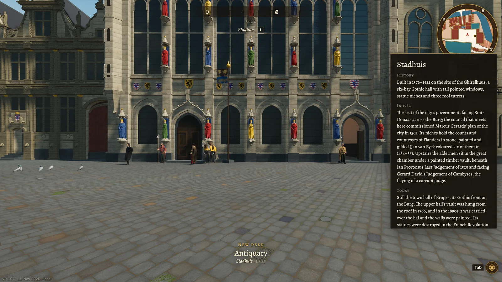
On the Burg church and power stand face to face. Sint-Donaas, the counts’ first church and since 1559 a cathedral, faces the Stadhuis of 1376–1421, where the aldermen sit. Beside them stand the chapel of the Holy Blood, the civil registry of the Griffie, the house of the Brugse Vrije, the court of the countryside round Bruges, and the town prison in Het Steen. At ten the town’s bell rings and its proclamations are cried from the balcony over the hall gate.
Daily life
The Sint-Janshospitaal has cared for the sick since about 1150. Inns stand on the squares and along the main streets, and the parish churches of Sint-Salvator, Onze-Lieve-Vrouw and Sint-Jakob still have their churchyards round them. Pupils can talk to the people in the street (E): most of what they say is everyday talk, and now and then a line carries a sourced fact of 1562.
An old map against today’s
Most of the street plan has not moved since the sixteenth century, so a plan of 1562 can still be read against a map of today. What changed is often what was filled in or pulled down: the Kraanrei was filled in after the Waterhalle went, and the Sint-Jansbrug made way for the Jan van Eyckplein. The guide to the map of Marcus Gerards shows the plan of 1562 and how to read it.
Short assignments
- Find these buildings. Give pupils a list: the belfry, the Waterhalle, the Kraan, Ter Beurze, the Schoenmakershuis, the Sint-Janshospitaal and Het Steen. With the map (M) they set a mark and the compass points the way. At each building they open the history card (I) and write one sentence on what it was for in 1562.
- Compare the plan of 1562 with the walk. Give each group a piece of the old plan and one street on it. They walk that street and note what matches, what does not, and why. The plan gives the form of roofs and gables; the line of the streets comes from measured maps.
- What changed since. Each pupil takes five landmarks and reads the "today" part of their card, or of their page under the buildings. They sort them into still standing, much changed and gone. The guide to the lost buildings helps with the last group.
- From the top of the belfry. Pupils climb the belfry and name the towers they see. Then they compare the view with a photograph from the belfry today: Sint-Donaas is missing, and the belfry has lost its timber spire, which burned in 1741.
- How do we know? Several cards say plainly what is not recorded, for example those of the Craenenburg, the Wolhuis and the English nation house. Pupils find such a sentence and discuss how a historian fills a gap, and when it is better not to.
What is history and what is a guess
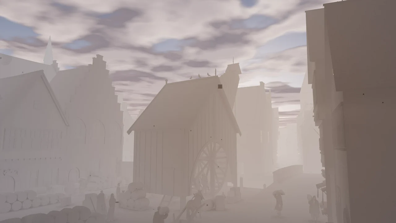
The street plan, the plots, the ground and the position and heights of the landmarks that still stand are measured. What stood where in 1562, building dates and what each landmark was used for come from sources: every claim is an entry in a ledger that cites 766 sources. The form of vanished buildings, interiors, colours, the fronts of ordinary houses and the dress and number of the people in the street are reconstructed. The 2,772 ordinary houses are typical of the period, not portraits of the houses that stood there. The story and its people are invented. The page about the reconstruction explains the method.
In practice
- Bruges 1562 is free. It opens with an access code: put your name on the waiting list and the code comes by mail.
- Each pupil needs a computer with Chrome or Edge, a keyboard and a mouse or trackpad. Nothing is installed. Phones, tablets and Safari cannot open it yet; the help page says which computers work.
- The download is about 85 MB and the first load takes around 40 seconds on a recent laptop. Open it before the lesson, and try it first on one school computer.
- As a guest a pupil walks the Markt, the Burg and the streets round them. A free account, with a name and an e-mail address, opens the whole town.
What there is to do in the city is on the page Bruges in 3D.
Questions
Can I use Bruges 1562 in a history lesson?
Yes. It is free, it opens in a browser, and every landmark has a history card written from sources.
Is it free for schools?
Yes, it is free for everyone. The access code comes by mail from the waiting list.
Does it work on a tablet?
No, not yet. It needs a computer with Chrome or Edge. The help page says which computers work.